

Garmin Trailhead Series Appalachian Trail microSD
Lowest Price
$59.51
MSRP
$63.99
Savings
7% off
In Stock at
0 Stores
Updated
Unavailable
Watch this deal
Get an email when price or stock moves on this product.
Improve this listing
Send structured deal feedback for moderator review.
Compare Deals from 1 Retailers
Lowest price first

Specifications
Description
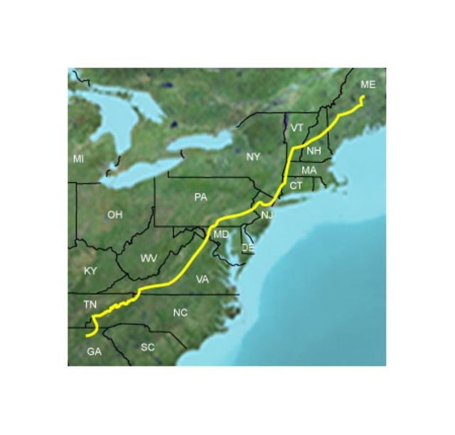
Garmin Trailhead Series Appalachian Trail microSD. Prepare for your next backpacking hiking or camping adventure with this Garmin GPS Accessory contains detailed 24K topographic maps for the entire national trail and an additional ten miles of extended 24K coverage on either side. Trailhead Series Maps from Garmin offer built-in digital elevation model data that supports 3D terrain shading and route elevation profiles in compatible units to help estimate terrain difficulty. This GPS accessory also includes a fully routable trail from beginning to end and a points of interest database which allows you to search by name or proximity to your location. Specifications for Garmin Trailhead Series 010-C1058-00: Format: microSD with SD card Coverage: Includes coverage for the Appalachian Trail plus 10 mi (16 km) of extended coverage on each side of the trail Compatible with: Oregon and Colorado series navigators to access full 3-D view and terrain shading or use with the new rugged high-performance Garmin handhelds including GPSMAP 62s 62st GPSMAP 78 78s 78sc or Dakota 20 Partial compatibility with: Edge 605 705 800 eTrex x-series Rino x-series Astro 220 GPSMAP 60CSx 60Cx 76CSx 76Cx 620 nuvi 500 series Features of Garmin Appalachian Trail microSD 010-C1058-00: Digital topographic maps equivalent to 1:24000 scale U.S. Geological Survey maps Coverage of the entire trail with ten miles of extended coverage on either side Fully routable trail from beginning to end plus basic road coverage available as a reference Searchable points of interest including geographic place names wilderness areas businesses and more Dense contour interval generated from elevation data approximating the 24K USGS quad maps Built in DEM and 3-D terrain shading on compatible units and enhanced shoreline equivalent to 24K Elevation profile of routes and tracks on compatible units helps you estimate terrain difficulty Detailed lakes rivers and streams plus summits trailheads towns and natural features National state and local parks forests recreational and wildlife area boundaries Bureau of Land Management township range and section information and USGS quad names available when reviewing a location Package Contents: Garmin Trailhead Series Appalachian Trail microSD/SD card 010-C1058-00
Similar Products


Garmin
GARMIN eTrex 32x
$299.49 $299.99
● In Stock

MSRP
Garmin
Garmin eTrex 22x Handheld GPS Unit
$199.99
● Limited Stock

Garmin
GARMIN GPSMAP 65
$349.49 $349.99
● In Stock
