


Similar Products


Product Details
MSRP $999.99
MPN 010-02921-00
UPC 753759329723
Description
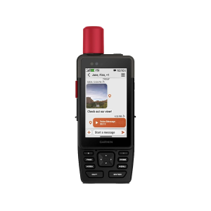
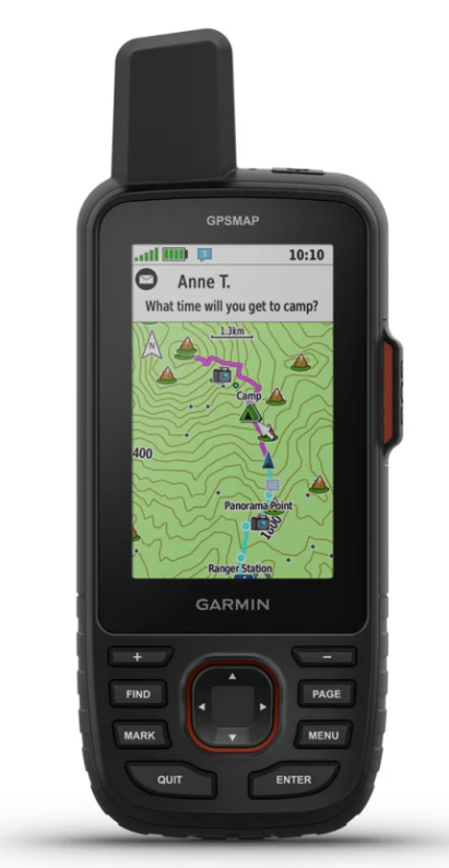
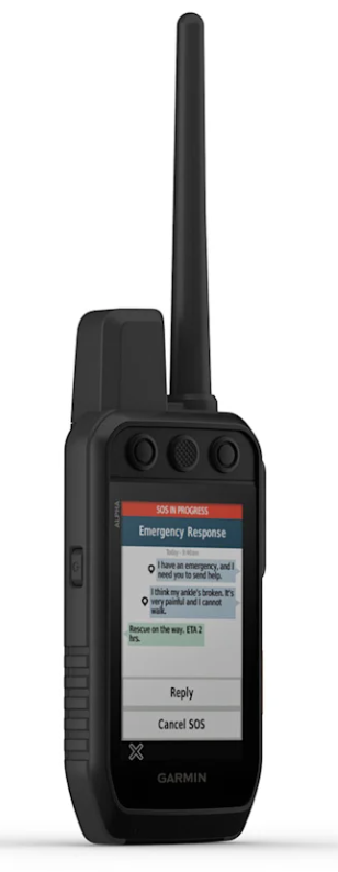
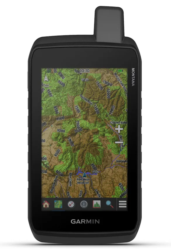
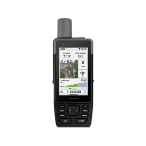
Garmin H1i Plus GPS Map Black. GPSMAP H1i Plus is the rugged GPS handheld navigator with built-in inReach Plus technology thats ready for the wild (active satellite subscription required; some jurisdictions regulate or prohibit the use of satellite communication devices). Its hybrid design boasts a bright 3.5in color touchscreen display physical buttons for versatility and a long battery life of up to 145 hours in GPS mode. You can stay in touch with loved ones when you venture beyond cell service by exchanging texts or using the built-in camera/mic to snap and share photos and voice messages. You can also trigger an SOS message to the 24/7-staffed Garm ResponseSM international coordination center for assistance in an emergency. Navigate with preloaded TopoActive maps downloadable satellite imagery and the option to purchase an Outdoor Maps+ subscription for ongoing access to premium map content. Multi-band GPS and multi-GNSS support gives you optimal positional accuracy for precise knowledge of where your adventure takes you. Specifications for Garmin H1i Plus GPS Map: Manufacturer: Garmin Color: Black Weight: 10.2 oz Dimensions: 2.6 x 7 x 1.3 in Display Size: 3.5 in Lens Material: Chemically Strengthened Glass Display Resolution: 282x470 pixels Battery Life: 145 hours Water Resistance Level: IP67 Battery Type: Lithium Ion Features of Garmin H1i Plus GPS Map GPSMAP H1i Plus navigator with built-in inReach Plus technology helps you stay in touch when you venture beyond cell service; with an active inReach satellite subscription you can exchange texts or use the built-in camera/mic to snap and share photos and voice messages (some jurisdictions regulate or prohibit the use of satellite communication devices) With an active inReach satellite subscription you can trigger an interactive SOS message to the 24/7-staffed Garmin ResponseSM international coordination center for assistance in an emergency (some jurisdictions regulate or prohibit the use of satellite communication devices) Rugged GPS handheld navigator boasts a slick hybrid design offering a bright 3.5in touchscreen that is sunlight readable glove-friendly and chemically strengthened glass to resist scratches; plus physical buttons provide more versatility in any conditions Navigate trails with ease by using preloaded TopoActive maps downloadable high-resolution satellite imagery and the option to purchase an Outdoor Maps+ subscription for ongoing access to a variety of premium map content Long battery life up to 145 hours in all Satellite Systems + Multi-Band mode assuming typical use with SatIQ technology; up to 845 hours in Expedition mode Multi-band GPS and multi-GNSS support for optimal positional accuracy and precise knowledge of where you are Built to meet MIL-STD 810 for thermal shock water (IP67) and vibration to withstand weather and extreme temperatures Compatible with the Garmin Explore smartphone app for seamless trip planning locating geographic points and route-sharing capabilities Integrated front and back cameras allow you to snap selfies and photos of your trip Use the built-in flashlight as a beacon to signal for help or use as a torch to light your way when the path goes dark Use voice commands to conveniently handle many tasks including check-ins start tracking take a photo and more; available in English German Italian Spanish French Swedish Dutch and Danish. Built-in siren can be activated to emit a loud alarm to help draw attention if you are in need When you venture off-grid use LiveTrack location sharing to let friends or family follow your location while you are on the move; no need to point your device directly toward to sky to find satellites. They can see your progress including distance time and elevation. Pair GPSMAP H1i Plus navigator with the Garmin Messenger app on your mobile device to exchange photos voice and text messages even trigger an SOS message in an emergency all from the familiar interface of your smartphone (some jurisdictions regulate or prohibit the use of satellite communication devices) ABC sensors provide an altimeter for elevation data barometer to monitor weather and 3-axis electronic compass to provide direction Get weather reports and request forecasts for your destinations with an active inReach satellite subscription (some jurisdictions regulate or prohibit the use of satellite communication devices) Features an integrated Spine Mount 2 with included removable loop carabiner for more versaility on your adventure; compatible with additional Spine Mount 2 accessories (sold separately) Package Contents: Garmin H1i Plus GPS Map Loop Carabiner Charging/data cable Documentation Garmin 010-02921-00: H1i Plus GPS Map Black